Between the Brochs: Scoping the Coast with SCAPE!
Life in Caithness has meant a number of rituals passed - tumbling down the infamous 'monkey run' in Thurso at record speed, for instance - but also understandings of the world we inhabit are developed. Learning to deal with solitude, in a vast and open, seemingly remote and rural area. Learning to co-exist in and with small communities. You learn patience - with online deliveries - and you learn how to make the most of your days, especially in Summer (during this time you also learn about sunburn).
Growing up in Thurso has also meant, at least for me, an appreciation of the sea and our coastline. The sea has an irresistible allure, where the pull of the tides draw you closer. I believe it was Jacques Yves Cousteau who once said, "The sea, once it casts its spell, holds one in the net of wonder forever."
(Well, if you thought I actually knew that quote, you'd be wrong, I'm just saying it to make myself appear more knowledgeable. I don't even think it's a real quote. In fact, come on - do you expect me to believe that 'Jacques Yves Cousteau' is a real name? Pfft!)
But the sea and our coastline is a magical place. From sandy beaches to awesome cliff-faces, there's something for everyone. It is both ever-present and transient, an environment where ships sail slowly along the horizon, or bob about in the Firth; where gulls swoop and dolphins dive in and out of sight; where waves crash constantly, hypnotically, against cliffs. I recall Karen Munro, a local sea-spotter and photographer, succinctly remarking "There's always something going on..."
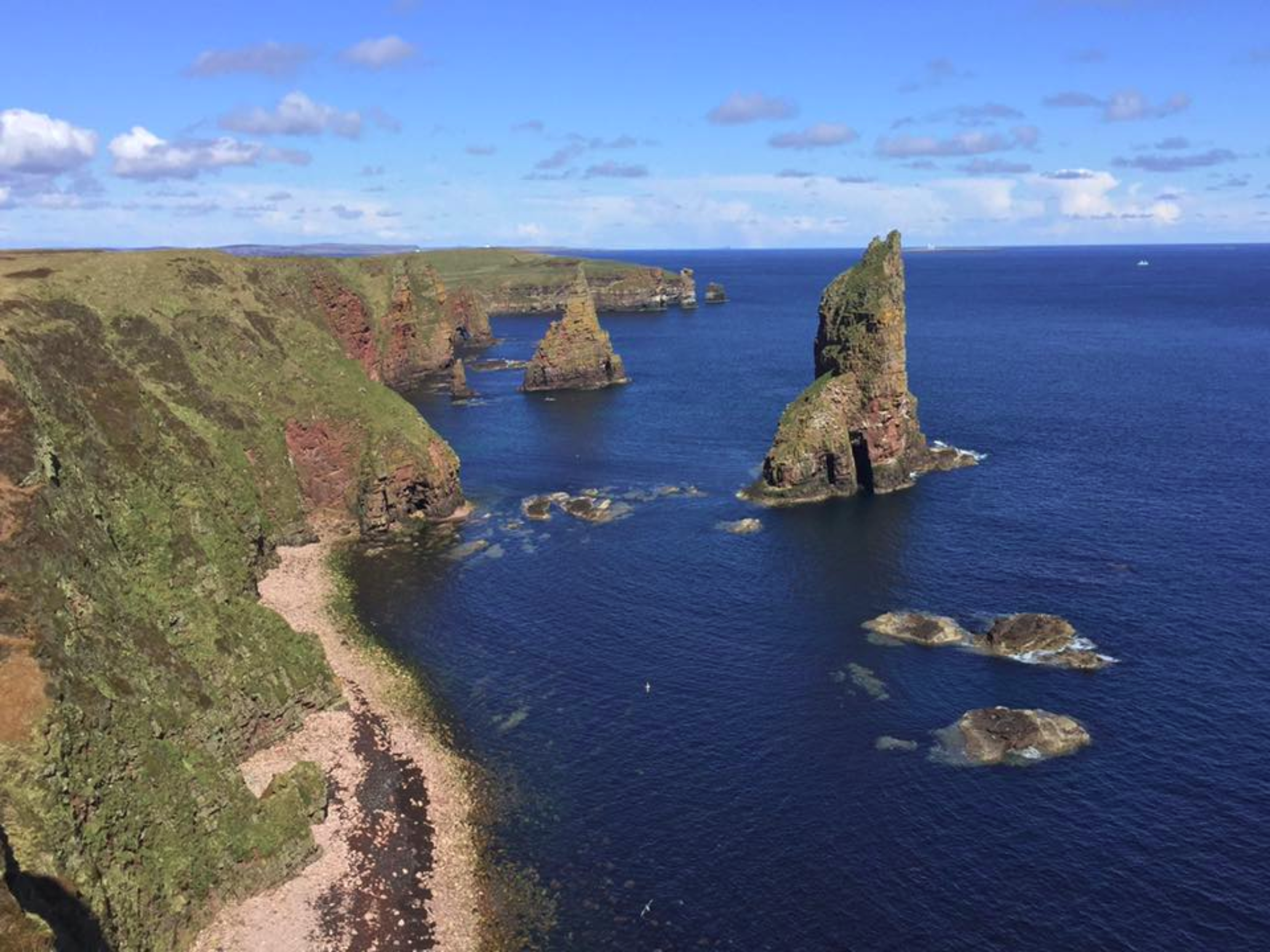
Duncansby Stacks: Photo by Karen Munro
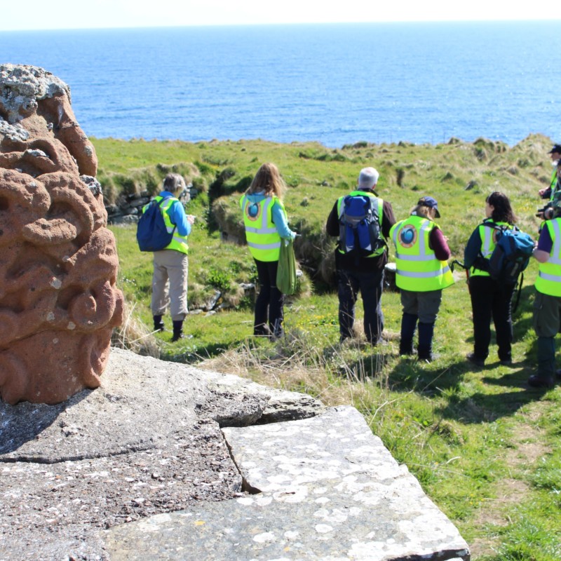
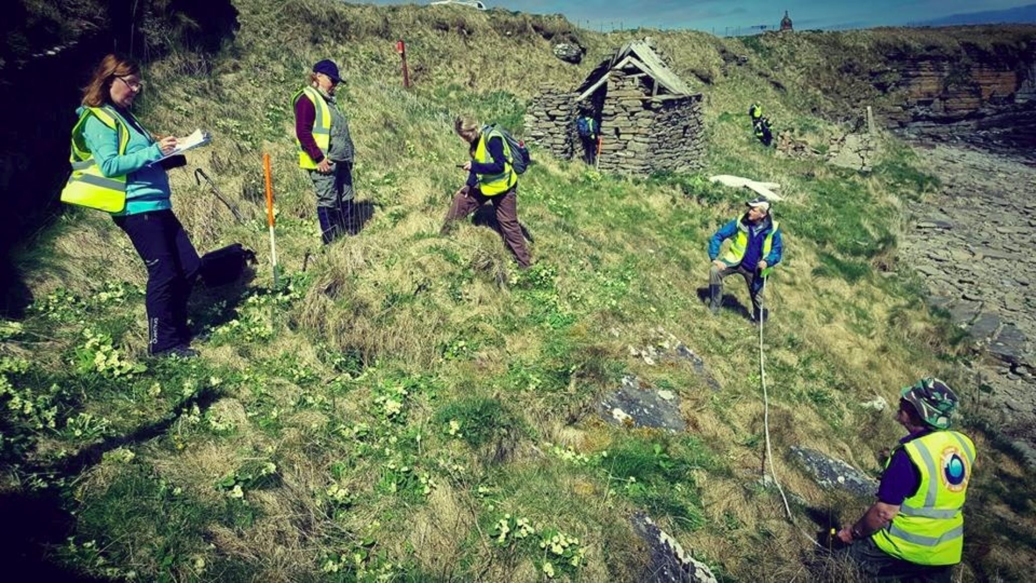
And this week, if you were anywhere near the East Caithness coast, you would have noticed something else to add to the list. You may have spotted 10 or 15 fluorescent jackets trawling the historic eastern coastline between Skirza and Nybster, as part of a Caithness Broch Project and Scottish Coastal Heritage and the Problem of Erosion (SCAPE) event.
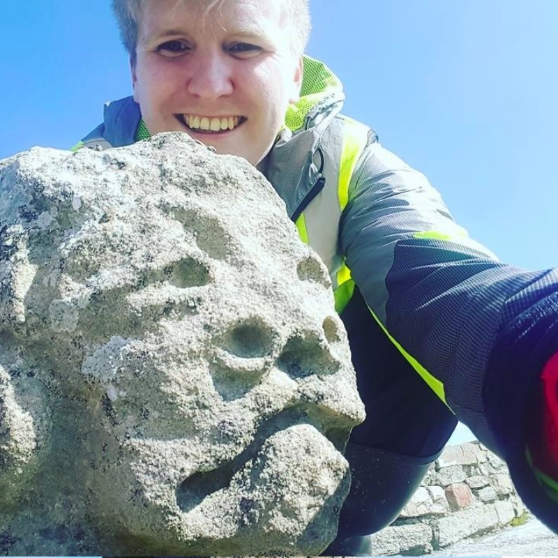
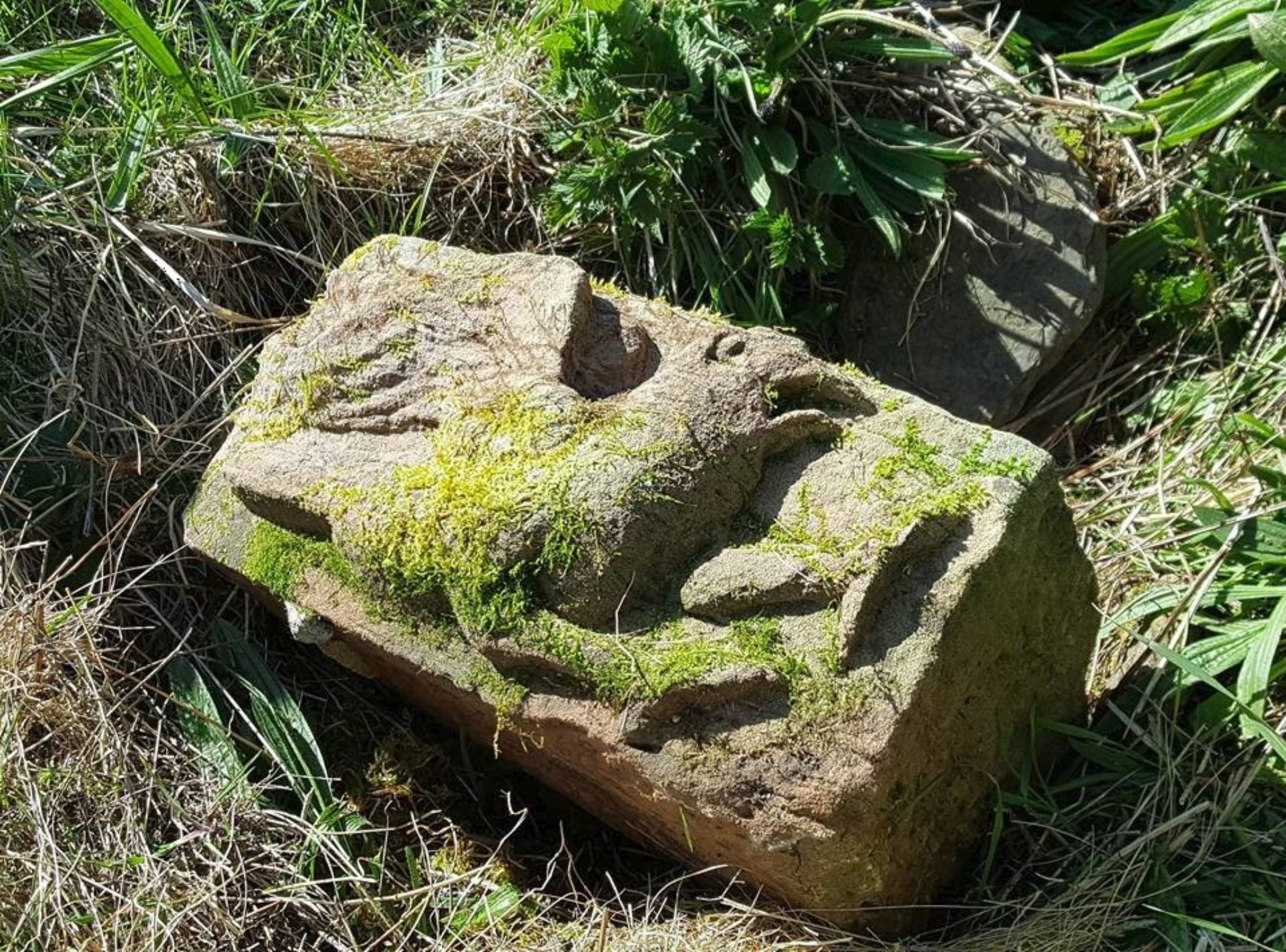
SCAPE are a St. Andrews University-based charitable archaeology group, set up to investigate the rapidly changing and dynamic coastline of Scotland. I first learnt of their activities in 2014, but I never actually managed to meet them until 2015, when I was working in Orkney. SCAPE were working on the beautiful island of Sanday in Orkney, and I was fortunate enough to join them for 3 days helping to excavate a prehistoric burnt mound (a bit of an archaeological hot topic, if you'll excuse the pun) at Meur. The highlight of adventure, for me, was finding a 'ard point', a stone used for hand-ploughing. And before you say anything else, yes, I am aware my hair is very Donald Trump-esque.
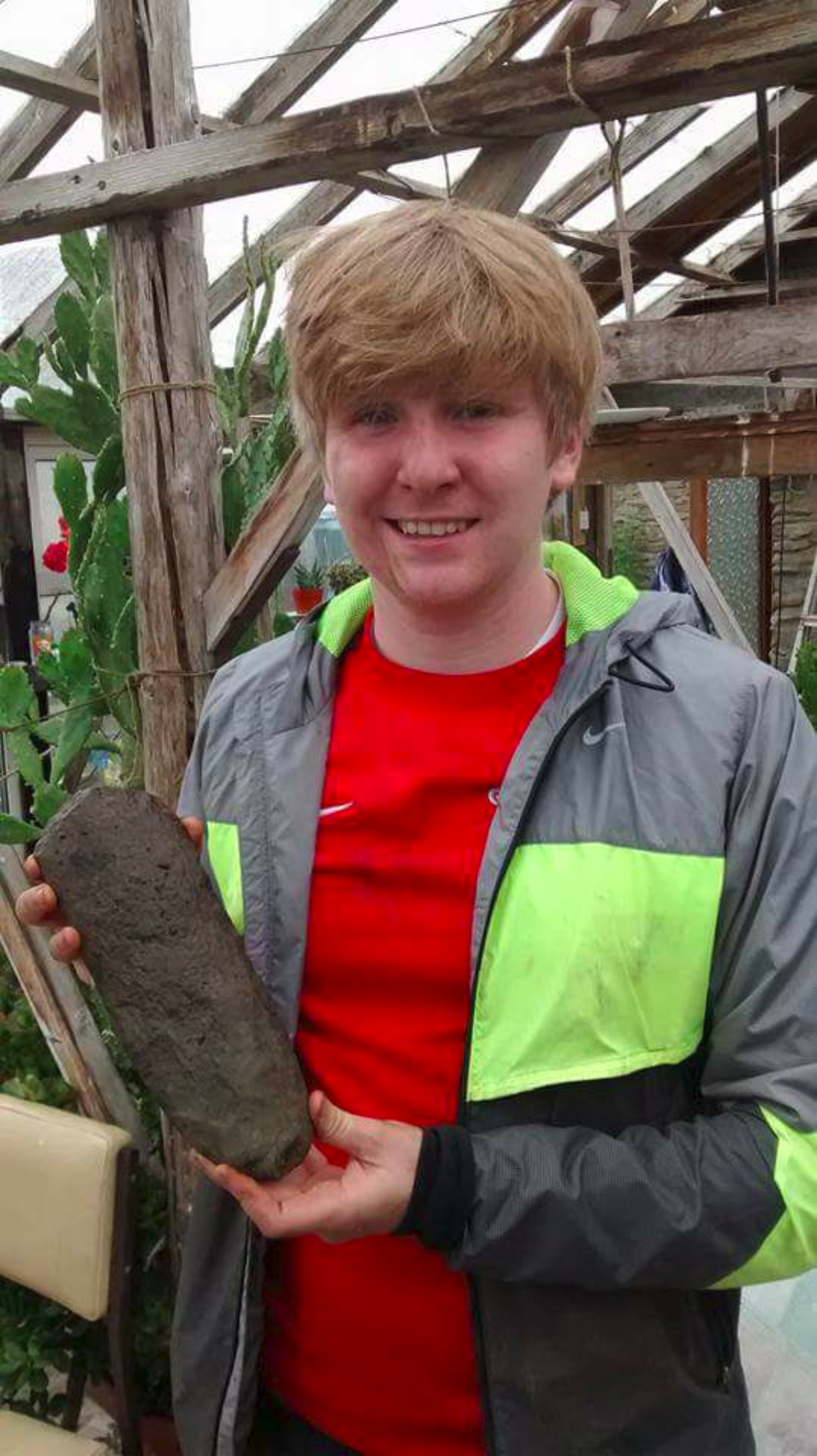
What's this? It's something between a rock and an ard point...
I was particularly impressed with SCAPE's openness in dealing with complete newbies to archaeology, and they were more than happy to give me a variety of jobs, from mattocking to surveying, as well as explaining their methods. They were also at hand to explain their mission - to record, research, conserve and promote the archaeology of Scotland's coast. SCAPE is especially interested in remains that are threatened by coastal erosion - and, given the rate at which the coastline can collapse and deteriorate, lends a sense of urgency and excitement to their initiative. Coastal erosion is a natural process, but surveys have shown that thousands of archaeological sites and historic remains are threatened with destruction.
Since 2000, SCAPE has worked with Historic Scotland, Local Authority archaeologists and a number of archaeological units to survey some of the most vulnerable stretches of the Scottish coastline, as part of their SCHARP project (which stands for Scotland's Coastal Heritage at Risk Project). All of the sites recorded can be viewed on this interactive map.
The SCHARP project has so far covered around 35% of Scotland's coast, and so SCAPE'S job is far from complete. Caithness is one area they were keen to survey, and so we got in touch to invite them up for 4 days of archaeological activity along the Caithness shoreline, as we were also keen to provide locals (and non-locals, as we were soon to discover) the opportunity to get stuck in to some archaeology. SCAPE put local communities at the forefront of their investigations, because, as they put it themselves, locals know the coastline better than anyone else!
We decided to call "Between the Brochs" - so called because we intended to explore the coastline between Skirza Broch, about 5 miles south of Duncansby Head and Nybster Broch, at Auckengill. This area is littered with prehistoric and historic remains, from cairns to WW2 defences...but more importantly, brochs!
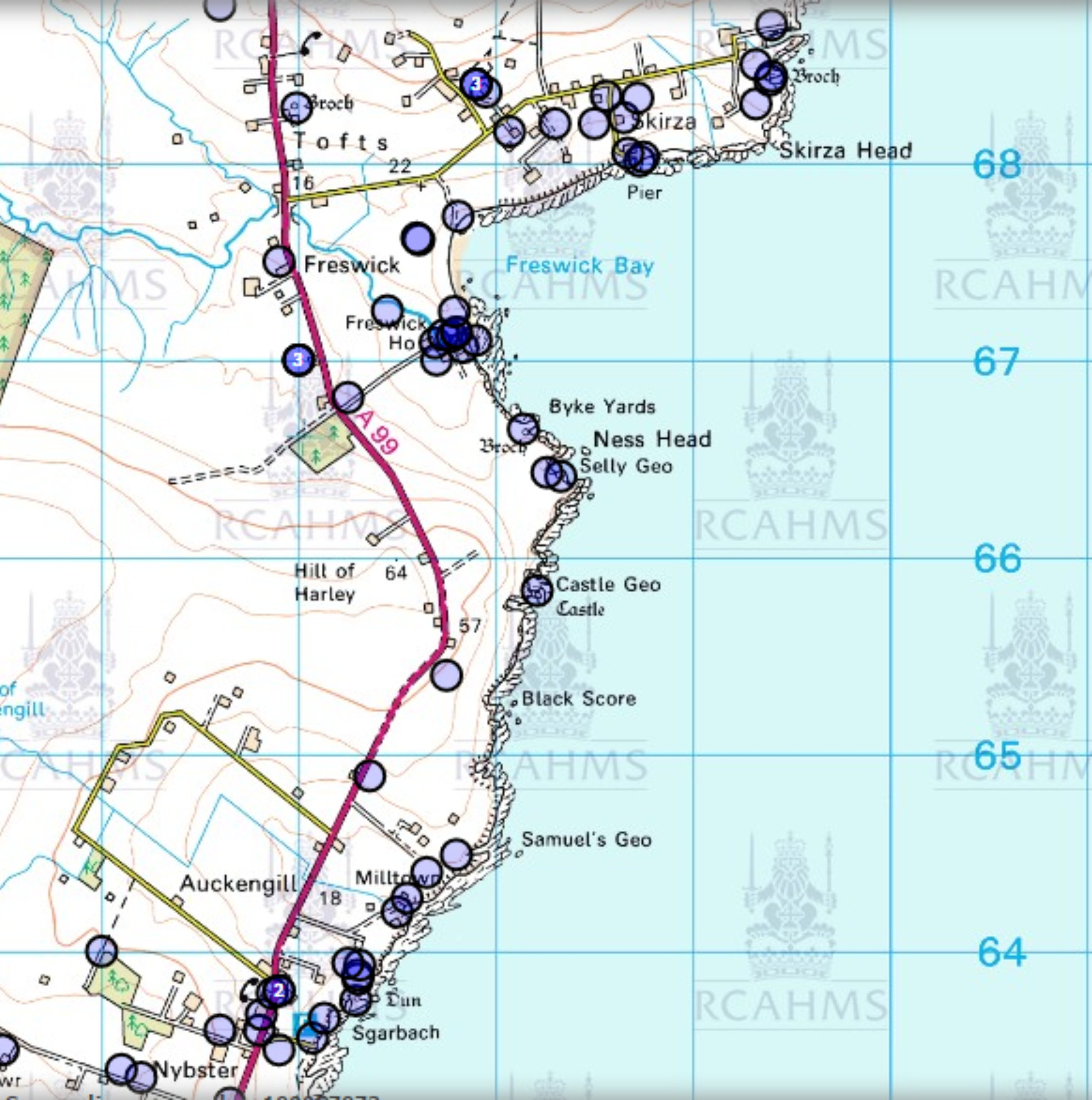
The stretch of coastline - little over 5 miles!
Before the undertaking the walk across the coastline, SCAPE organised a brief introduction and welcome at Wick Heritage Museum. Our colleagues for the weekend were Research Assistant Ellie Graham-Allsop and manager Tom Dawson who provided us with detailed insight into SCAPE's projects and plans.
It was great to meet with such a variety of individuals who each brought along a useful skillset - from coastguards (very useful) to writers to artists! It was also great to see that some had traveled from as far away as Glasgow to join us over the weekend.
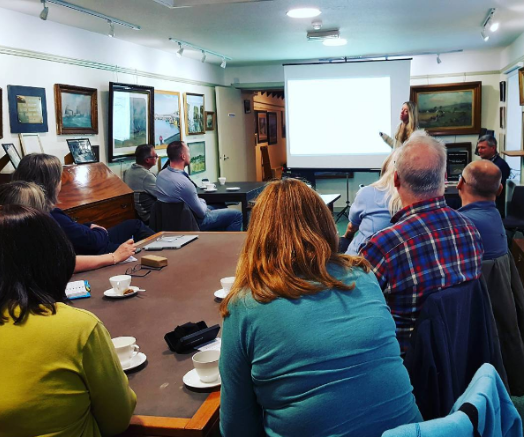
Ellie leads the discussion
Local history enthusiast and photographer Fergus Mather was also kind of enough to bring in some wonderful slides taken by Sir Francis Tress Barry, who would become something of a recurring theme over the course of the next 4 days!
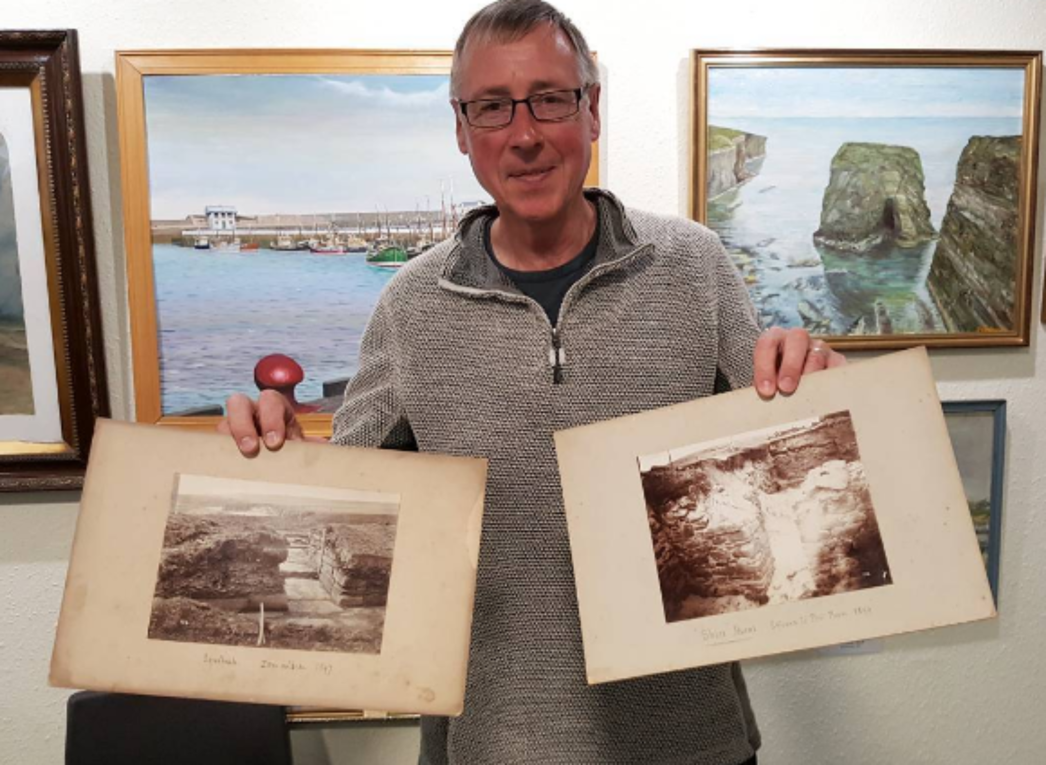
Fergus and his slides - they are well over 100 years old!
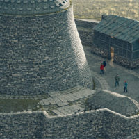
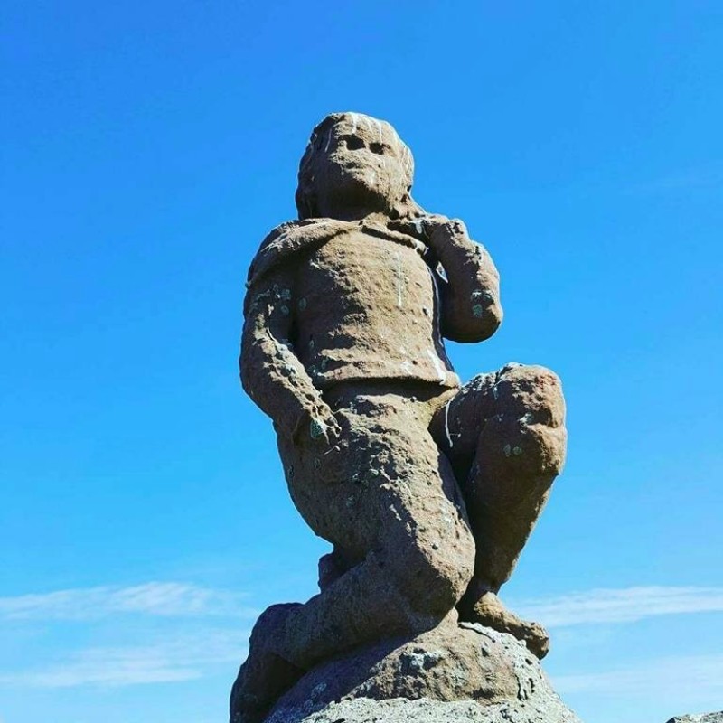
Our first survey (and sunny!) day began at Nybster, one of Sir Francis Tress Barry's most famous excavation sites. For those unacquainted with Sir Tress Barry's "work", I highly recommend a wander down to the Caithness Broch Centre at Auckengill, to get a better understanding of this famous - or infamous - antiquarian. Tress Barry (1825 – 28 February 1907) was a local landowner, who lived at Keiss and you cannot walk this stretch of coast without banging into some sort of ostentatious, bombastic and bizarre monument erected by himself - the most famous of which is 'Mervyn's Tower', which he dedicated to his nephew, and most likely incorporates material from the nearby Nybster Broch!
Many, if not all of the carvings found on these monuments were the work of Tress Barry's colleague John Nicholson (1858 - 1934), a local man with an interest in the local ancient and Norse history of the area, and a penchant for carving. We'll be investigating John's works in a later blog, so watch out for that.
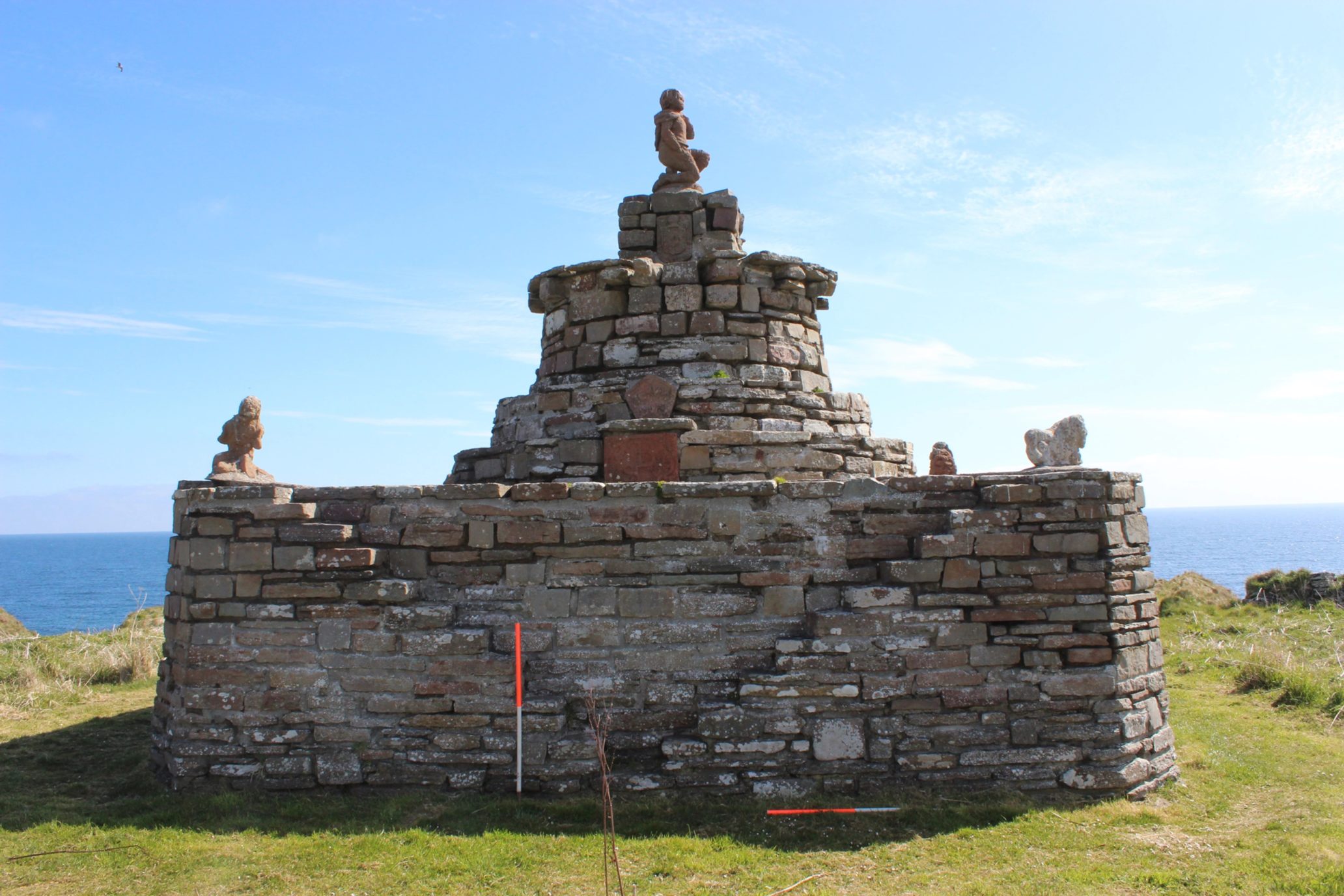
Mervyn's Tower, with 'naive' carvings by his colleague, John Nicholson
A selection of Nicolson's Carvings. Note the sad expression on the lion's face!
At Nybster we were presented with the opportunity to practice recording some of the sites using SCAPE's recording systems - good old fashioned pencil and paper, and their app. (If you want to download their apps and assist in the recording of our coastal heritage, then click here for Apple and here for Android.)
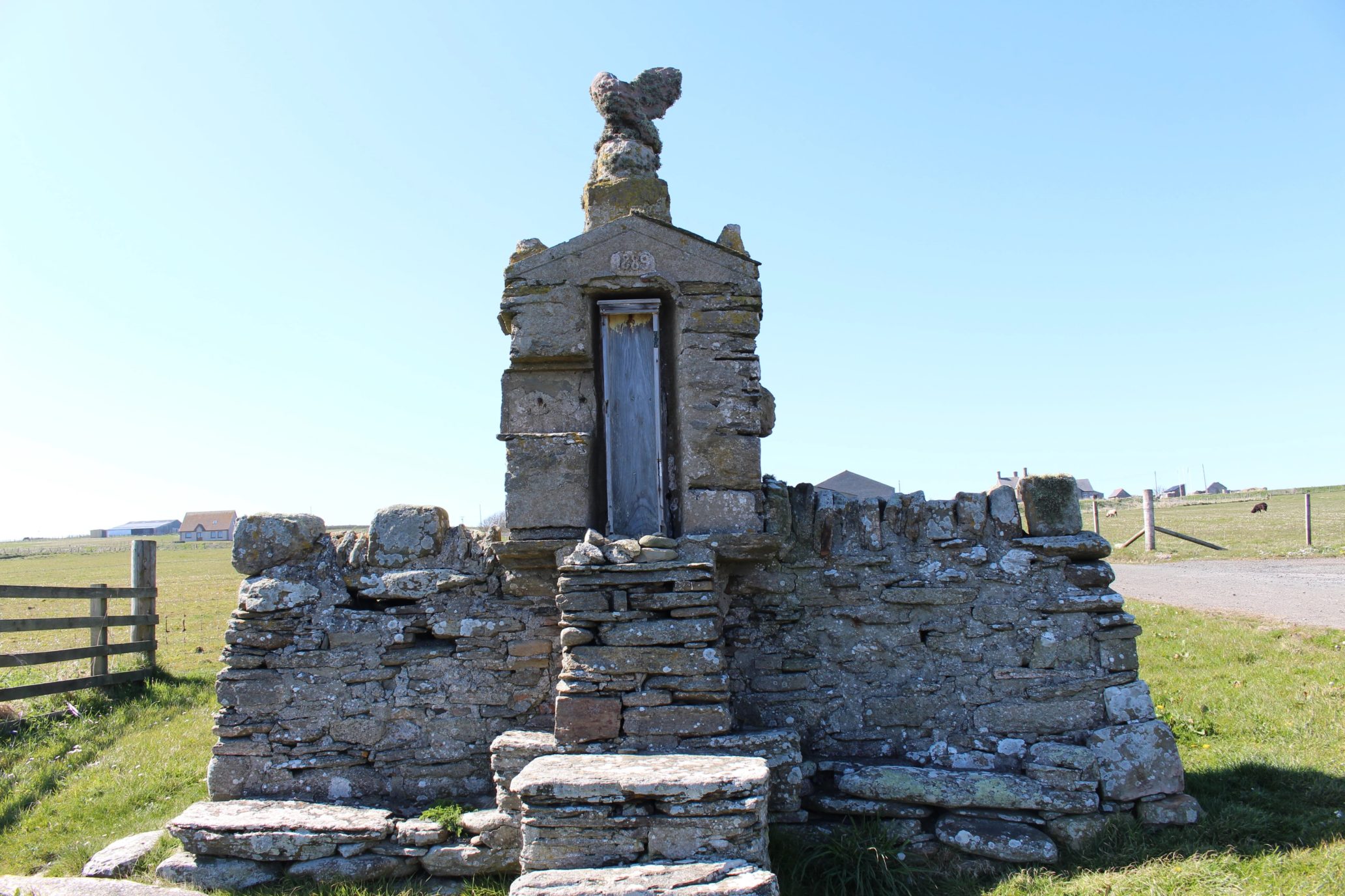
A Nicholson-built monument, which would have held a barometer at one point
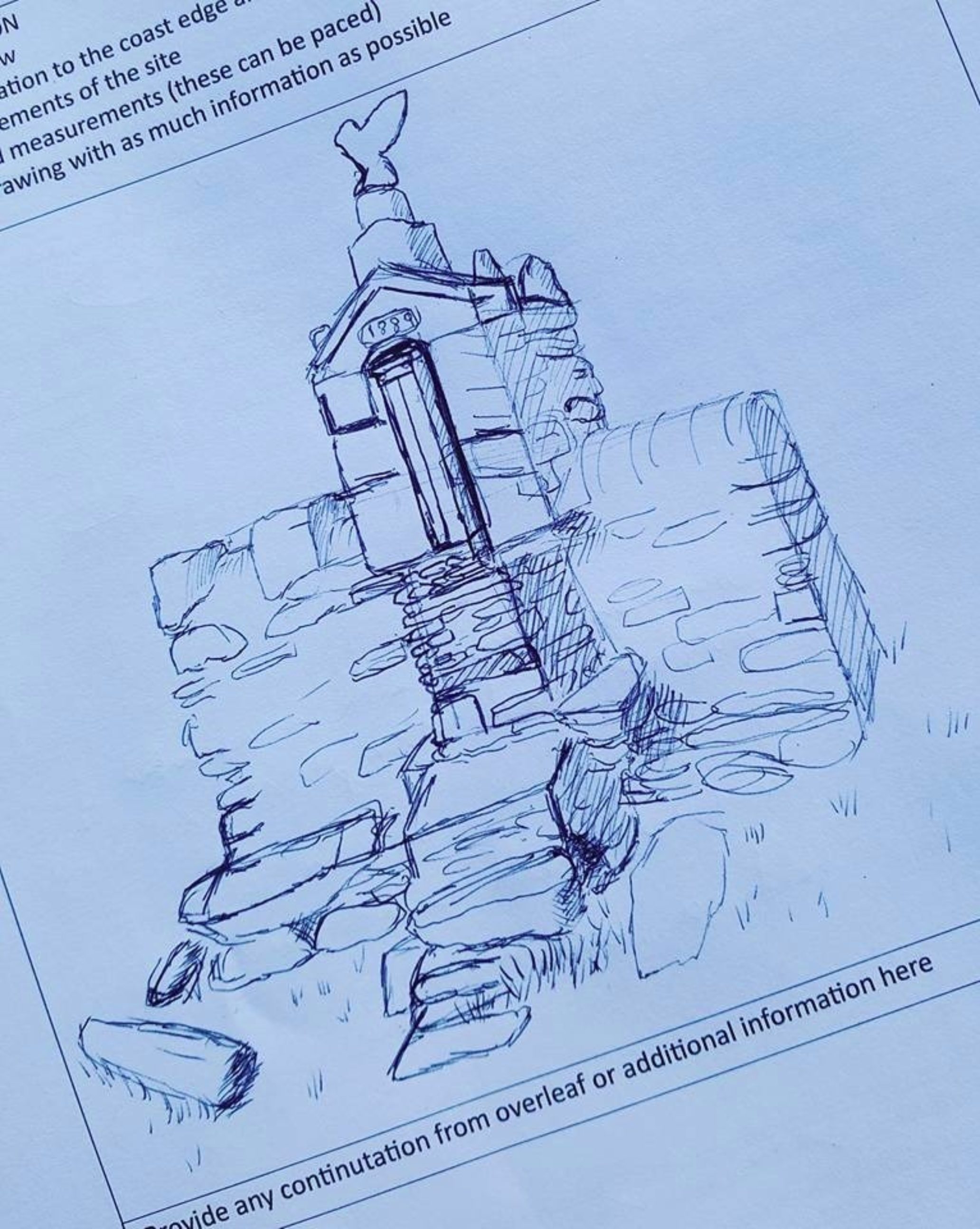
Kenneth's sketch of the monument
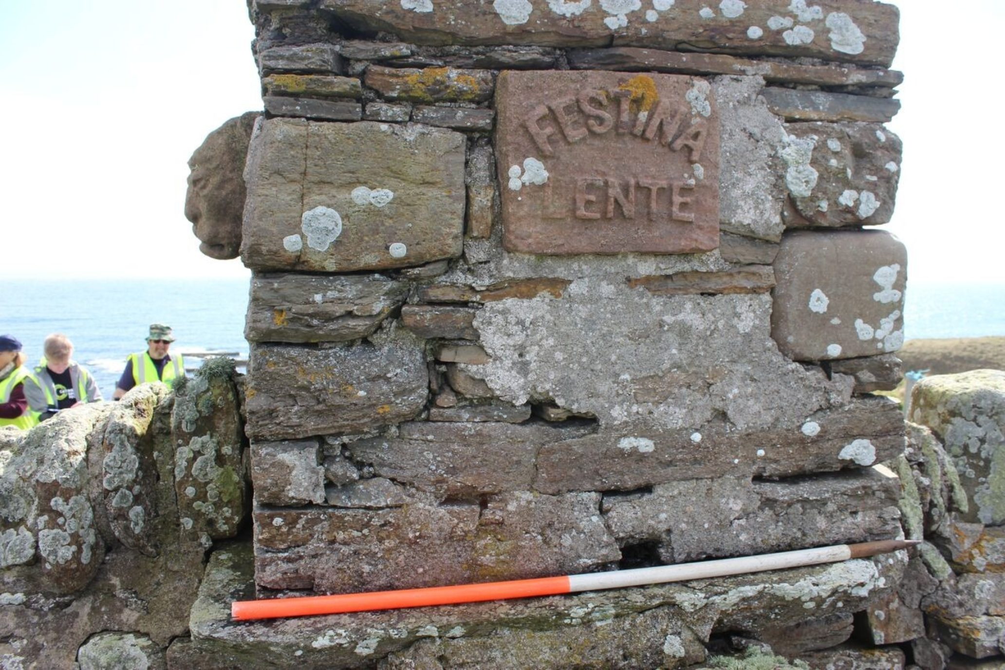
The monument from behind - 'Festina Lente' translates as 'Make Haste Quickly', something which jars with Tress Barry's archaeological methods, having excavated 14 brochs in 14 years!
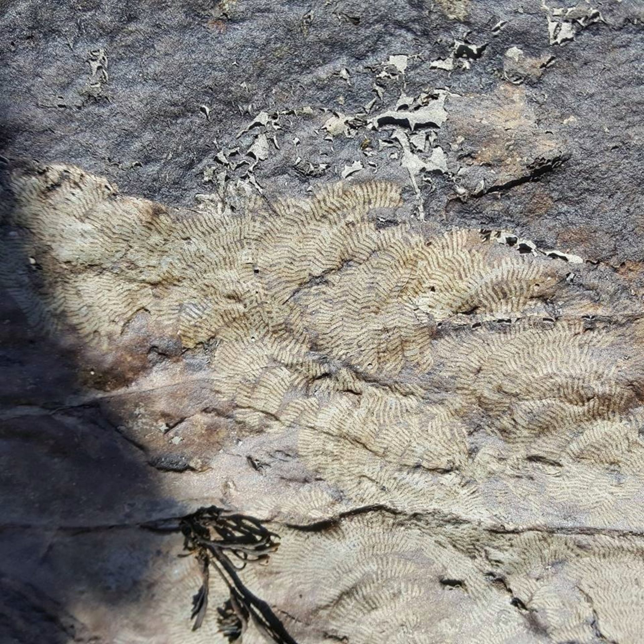
Further along the coast, one volunteer pointed out some fascinating and rather beautiful fern-like fossils (or marks left by seaweed?) down by the shoreline. Pretty, whatever they are...
Continuing round the coast, we were confronted by, well, what should have been nothing, as nothing had been recorded on SCAPE's interactive map. What insignificant, tiny historical detail hadn't been noted, you ask?
Oh, nothing much. Just this:
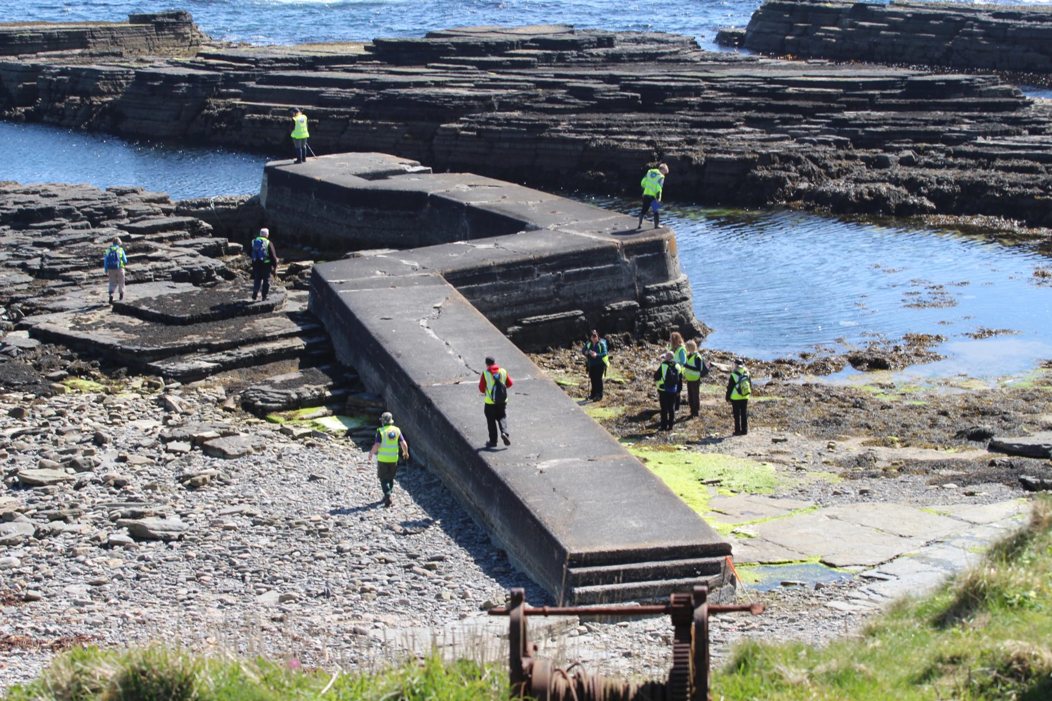
Yes, an entire PIER seems to have gone unrecorded - but that's why SCAPE are here!
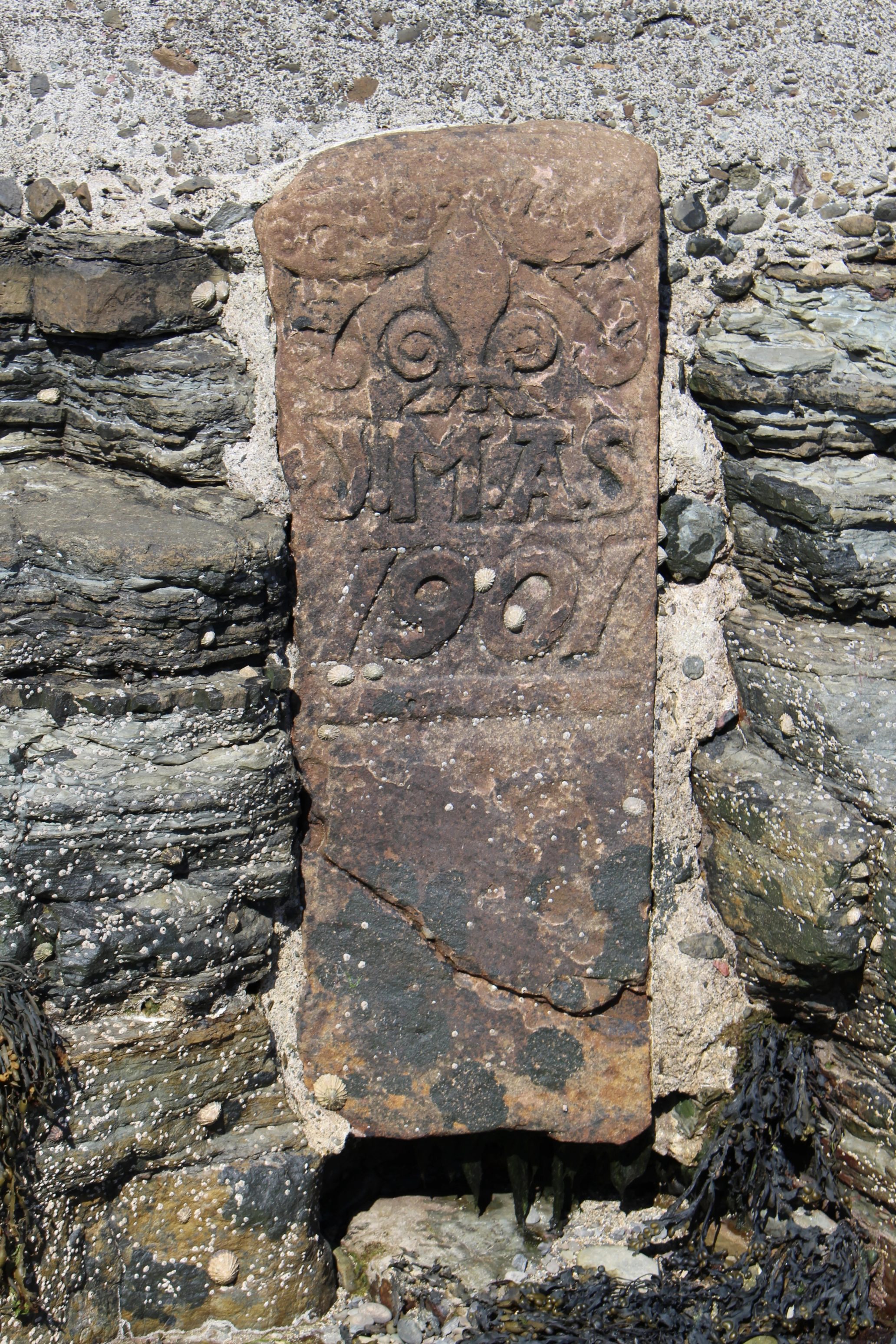
The volunteers investigated the pier and more detail, and came across a most interesting stone, built into the pier, with the initials 'JMAS' and a date of 1901. What was it for? Did it relate to the drowning of a sailor, or perhaps it was commemorating the construction of the pier. With no information to go back to, it was difficult to tell.
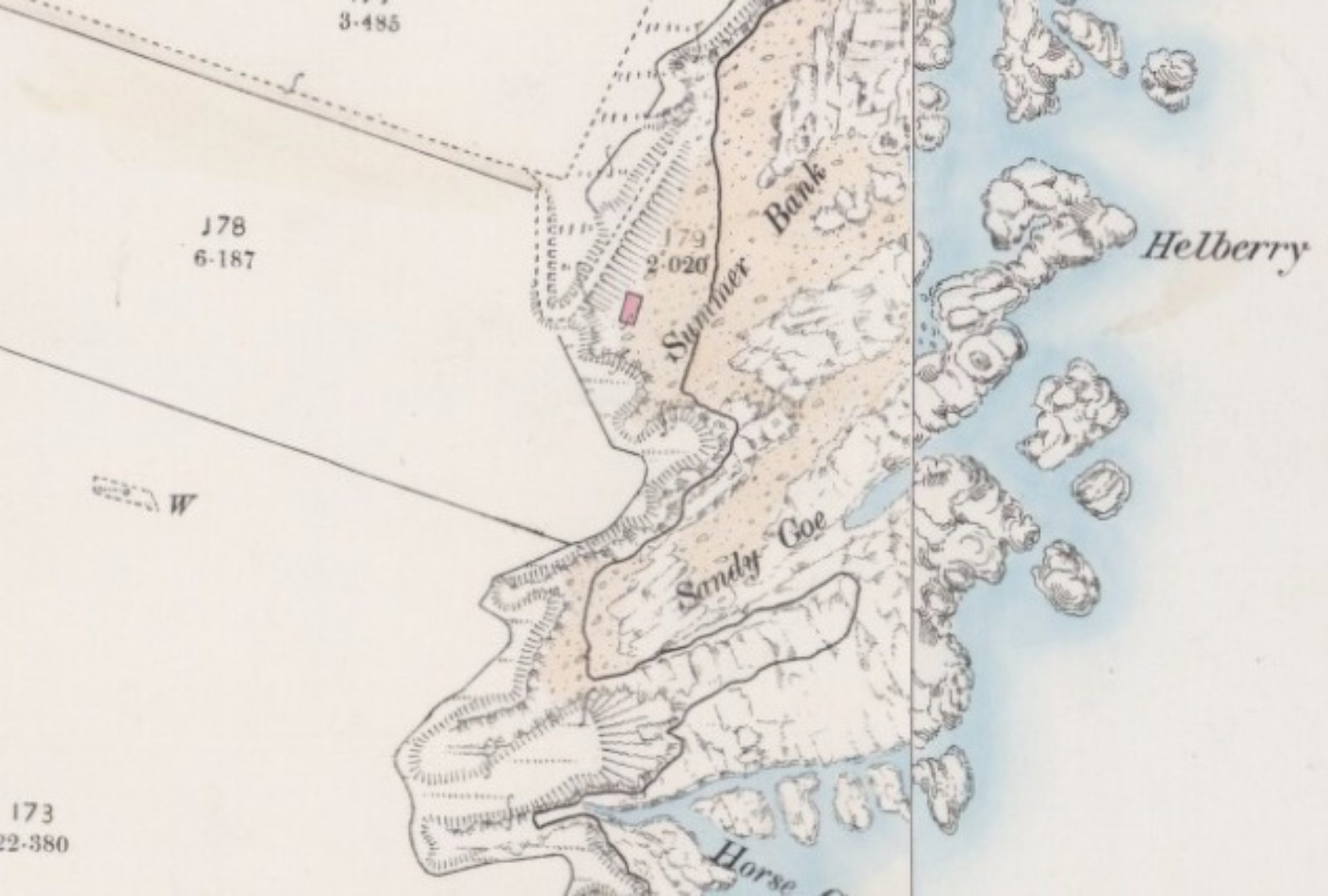
However, Ellie was able later to show us a bit more about this peculiar unrecorded site by using online resources from the National Library of Scotland, to try and find out when it may have been built. Ellie looked at the (rather beautiful) early OS maps.
First, she checked out the area on the 25-inch OS map, published in 1877. As you can see, there is no pier at 'Sandy Goe', where the pier is now found.
However, looking at the next available OS map, published in 1906, we can see a new addition:
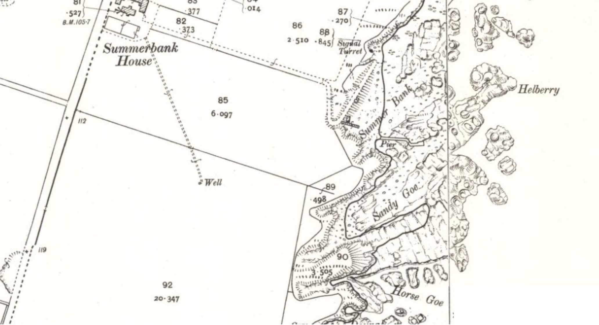
So, it appears the pier was built some time between 1877 and 1907 - and the stone found earlier in the day would seem to support that case. A great bit of sleuthing from Ellie there, but it just shows that there are numerous resources out there to make recording and researching our heritage much easier.
You may have also noted on the previous maps buildings at Summer Bank. In the first map, it shows a rectangle, coloured in pink - yet in the second map, it is now clear. The 'colouring in' of a rectangle signifies a roofed building; if the rectangle is clear, that means the building is now missing its roof.
After the pier, we investigated the buildings around this area, and managed to stumble upon yet another unrecorded building, which had almost been built into the cliffs. Tom pointed out that the building was made of a clay mortar, which would indicate either an early building, or, quite simply, whoever built it did not have enough money to purchase better materials. A new site is a new site, and we got to work recording the area.
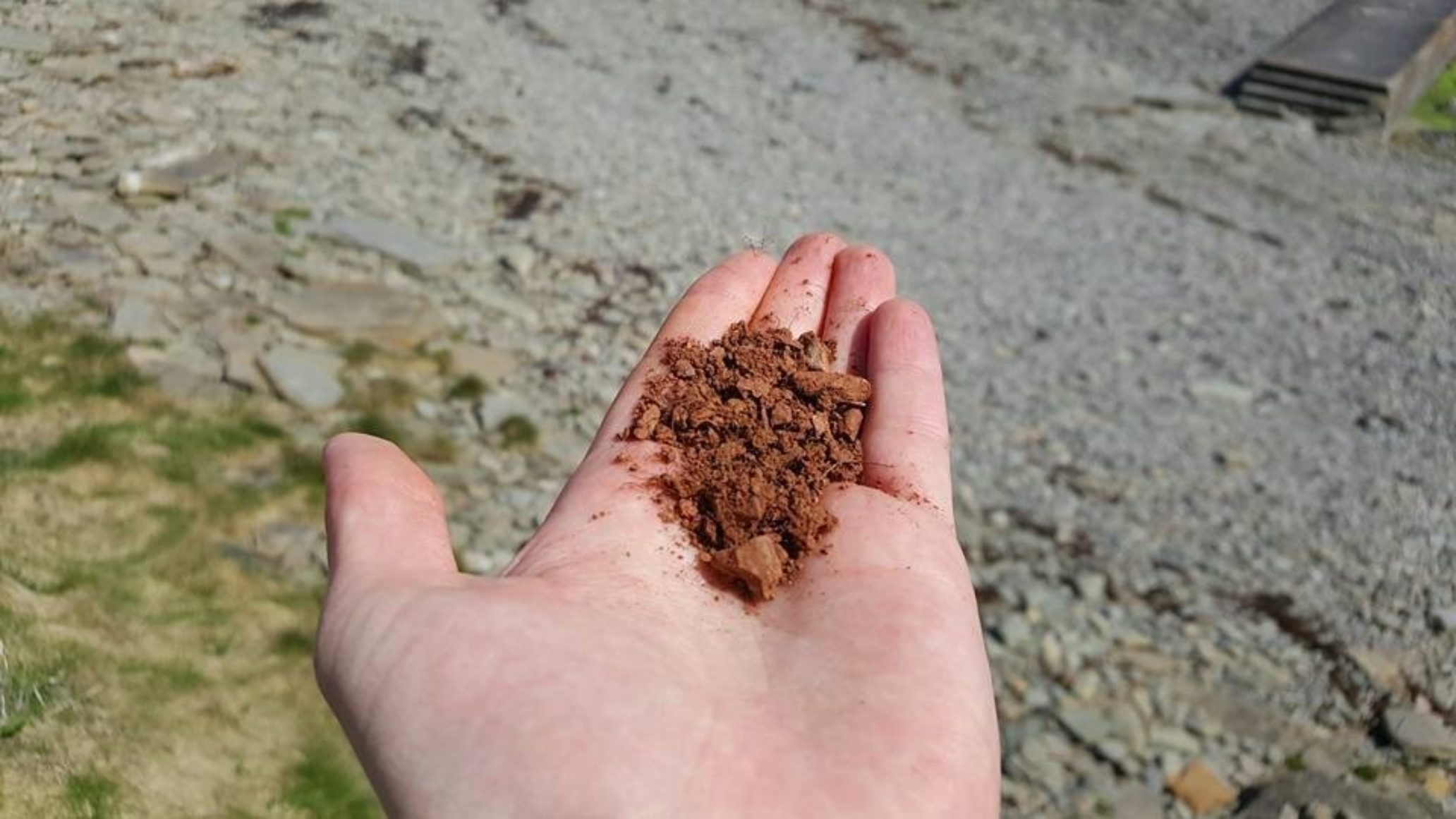
The reddish clay mortar
The team set out to measure and record the site
The Auckengill Harbour area wasn't finished yet though - another intriguing discovery was made when local volunteer Darren spotted what appeared to be a possible John Nicholson carving hidden in the turf, whom we mentioned earlier in the blog:
The carving appeared to be some sort of bird - in any case, that was pretty 'eagle eyed' of Darren...sorry...!
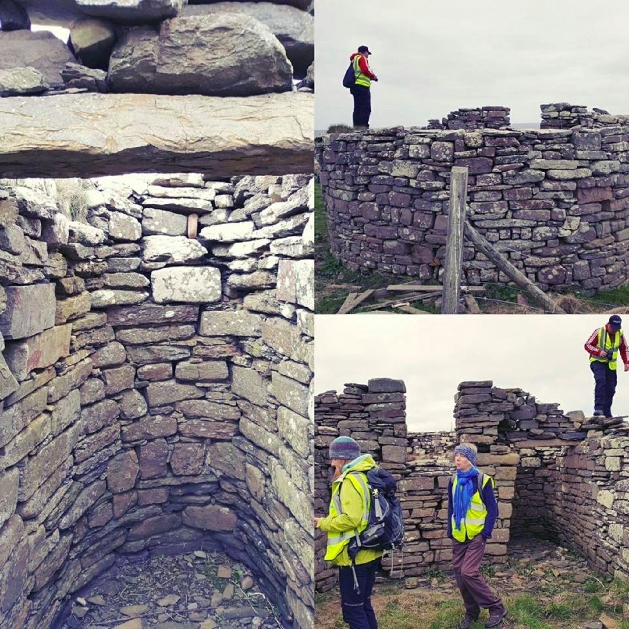
Further along the we were able to investigate yet more structures, such as the 'Sgarbach' promontory fort, which was excavated by Tress Barry, in 1897. Interesting to make the comparison between then and now...
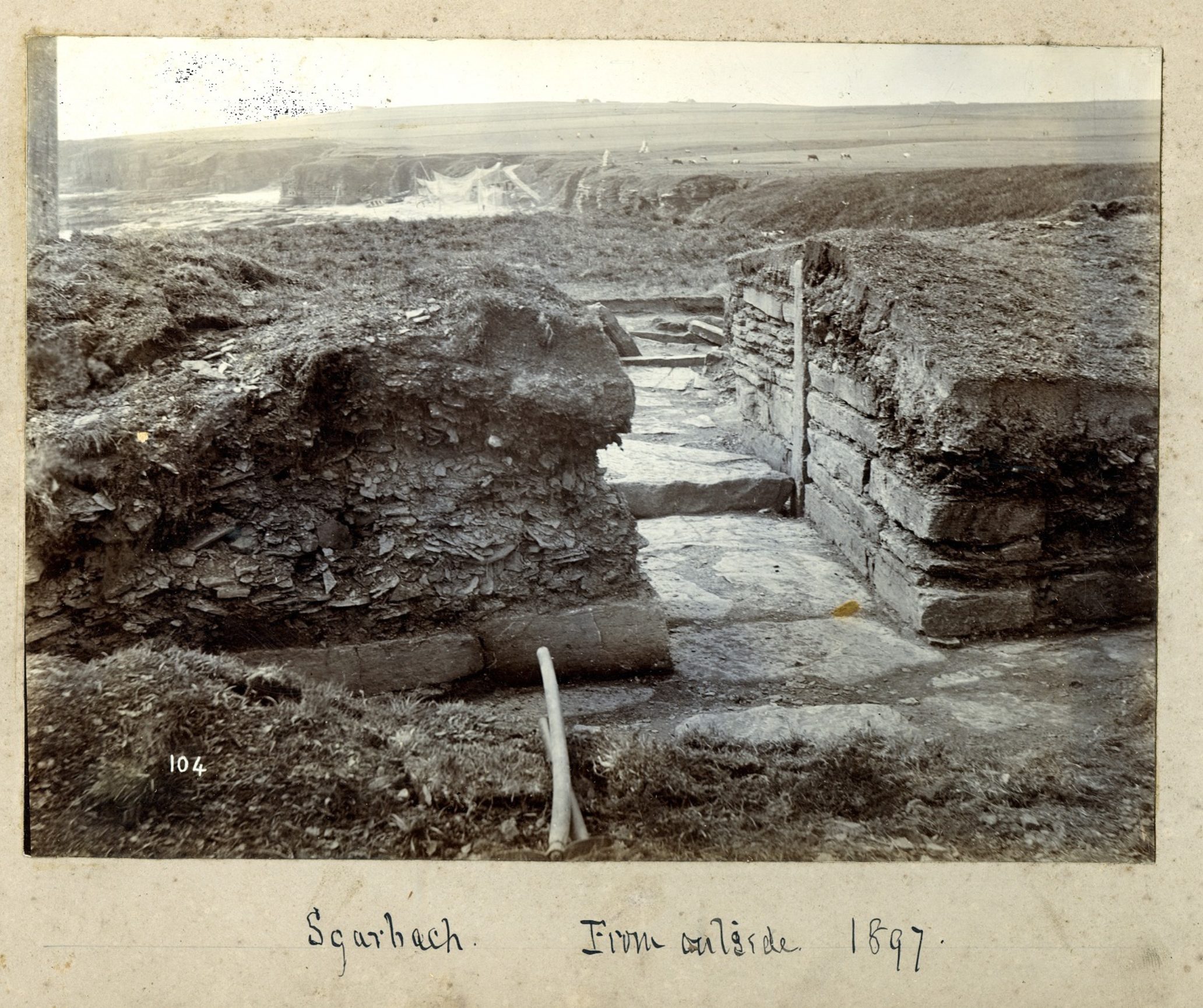
Then
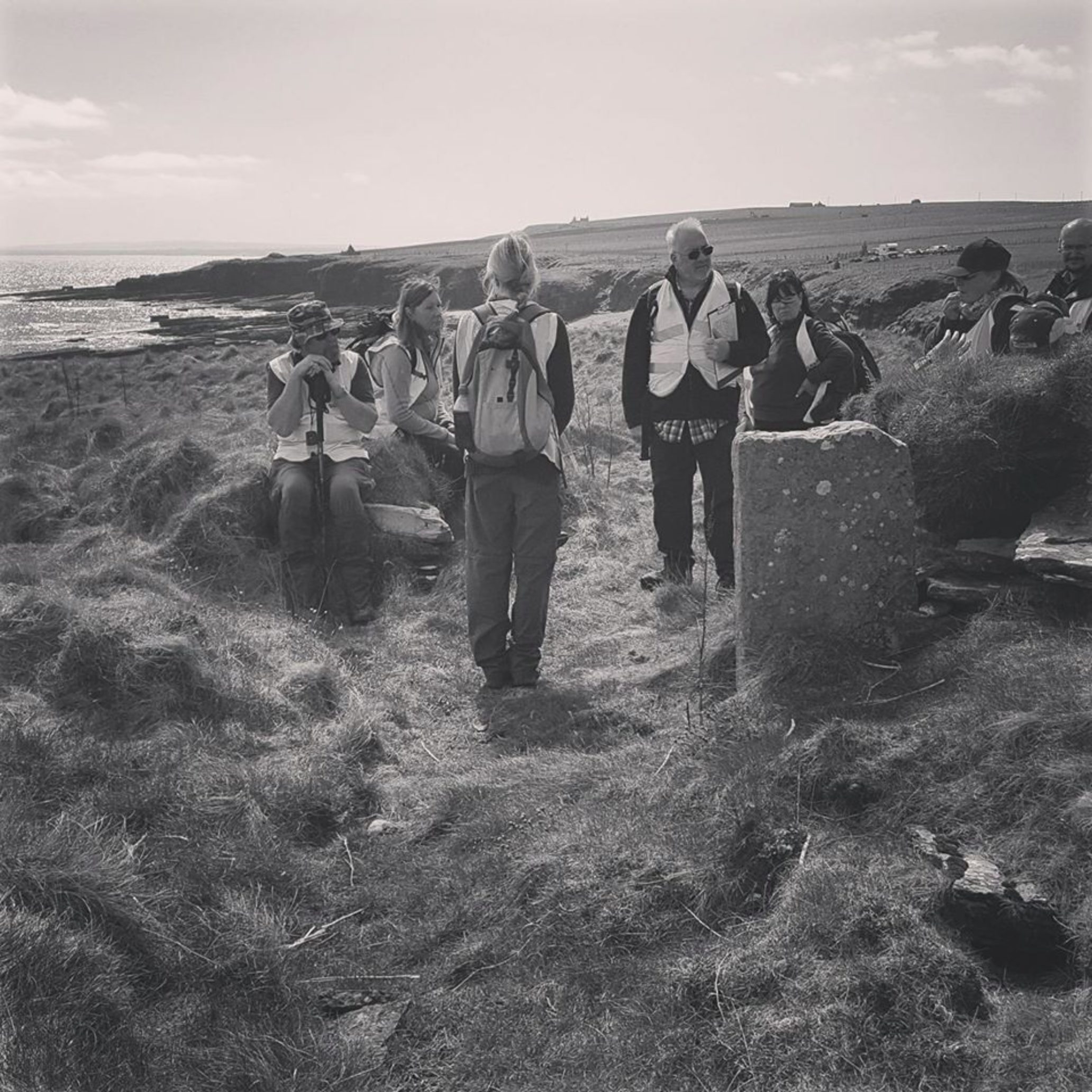
Now
And finally we popped by 'Milltown' which had an assortment of post-medieval buildings including a bridge, mill and croft house complete with a lovely corn kiln (see below), before heading back.
A fantastic day - helped by some truly gorgeous sunny weather - in which we were able to explore the exciting heritage and archaeology along the coastline. There's always something new to see, something fascinating to explore and arguably something important to learn along our coasts.
It's worth taking your time to go out and investigate these places yourself, many of which have been ravaged by both human hand and natural forces, before they are gone forever, but also to reflect on those who eked out a living here before us.
These considerations, for me, lend to both an appreciation and interest of the coast and the se,a and how it has shaped us throughout history and prehistory; but also it provides me with a sense of mindfulness.
I should probably insert another quote from Google at this point, but instead I'll quote the gentleman I met at Ellen's Geo, along the Caithness coast, at the edge of his farm. He too enjoyed the coast and the sea:
"Aye, it's grand...you can chust sit back an' watch what's going by... an' what's no'...."
NEXT WEEK - SCOPING THE COAST WITH SCAPE, PT.2